

Page Section
Services
/services
Land & Engineering Survey
Topographic, route and construction survey
Engineering Survey Services
High-accuracy land, route, utility, cadastral, construction and as-built surveys for transport, industrial, urban and energy infrastructure.
SURVEY2000 delivers precise engineering survey support for transport, industrial and urban development projects, with workflows that extend from primary control to as-built verification and digital deliverables.
Practical Insight
Engineering survey work creates the physical reference that design teams, contractors and owners rely on throughout a project lifecycle. Accuracy at this stage reduces layout disputes, utility conflicts and rework during execution.
Service Scope
Key Benefits
Core Deliverables

Hydrographic & River Intelligence
Bathymetry, charting and marine route studies
Hydrographic & Marine Survey
Bathymetry, current metering, route studies, dredging support, charting and seabed investigation from near shore environments to major river and port corridors.
The hydrographic team supports rivers, ports, shoreline works and marine infrastructure with disciplined field acquisition, calibrated positioning systems and reporting suited to planning, dredging and navigational studies.
Practical Insight
Hydrographic assignments demand more than sounding data. River and marine projects move more safely when positioning, current behaviour, seabed conditions and route constraints are studied together.
Service Scope
Key Benefits
Core Deliverables
Ground & Subsurface Analysis
Subsoil investigation and in-situ testing
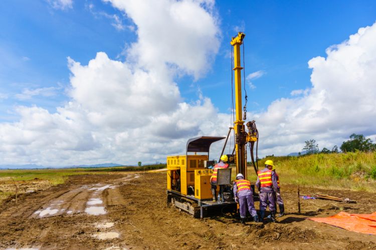
Geotechnical Investigation
Ground investigation, boreholes, CPTu, field and laboratory testing, geophysics, groundwater analysis and foundation engineering for demanding civil works.
SURVEY2000 undertakes ground investigation programmes designed to reduce design and construction risk through coordinated field testing, laboratory analysis and engineering interpretation.
Practical Insight
Geotechnical work has the strongest value when field data, laboratory results and engineering interpretation are coordinated early. That is what allows designers and contractors to work with fewer assumptions.
Service Scope
Key Benefits
Core Deliverables

Advisory, GIS & Delivery Systems
Consultancy, analysis and digital reporting
Consultancy & Data Management
Technical consultancy covering foundations, hydrology, GIS systems and evidence-led reporting for owners, EPCs and development agencies.
This service brings survey evidence, engineering interpretation and structured digital delivery together for clients that need decisions supported by reliable data and clear reporting.
Practical Insight
Technical value is lost when data is collected well but delivered poorly. This service ensures that field findings are translated into formats decision-makers, consultants and construction teams can act on quickly.
Service Scope
Key Benefits
Core Deliverables